Arouca
A town of the Paiva valley whose whole territory is a UNESCO-listed geopark of schist, waterfalls and river walkways.
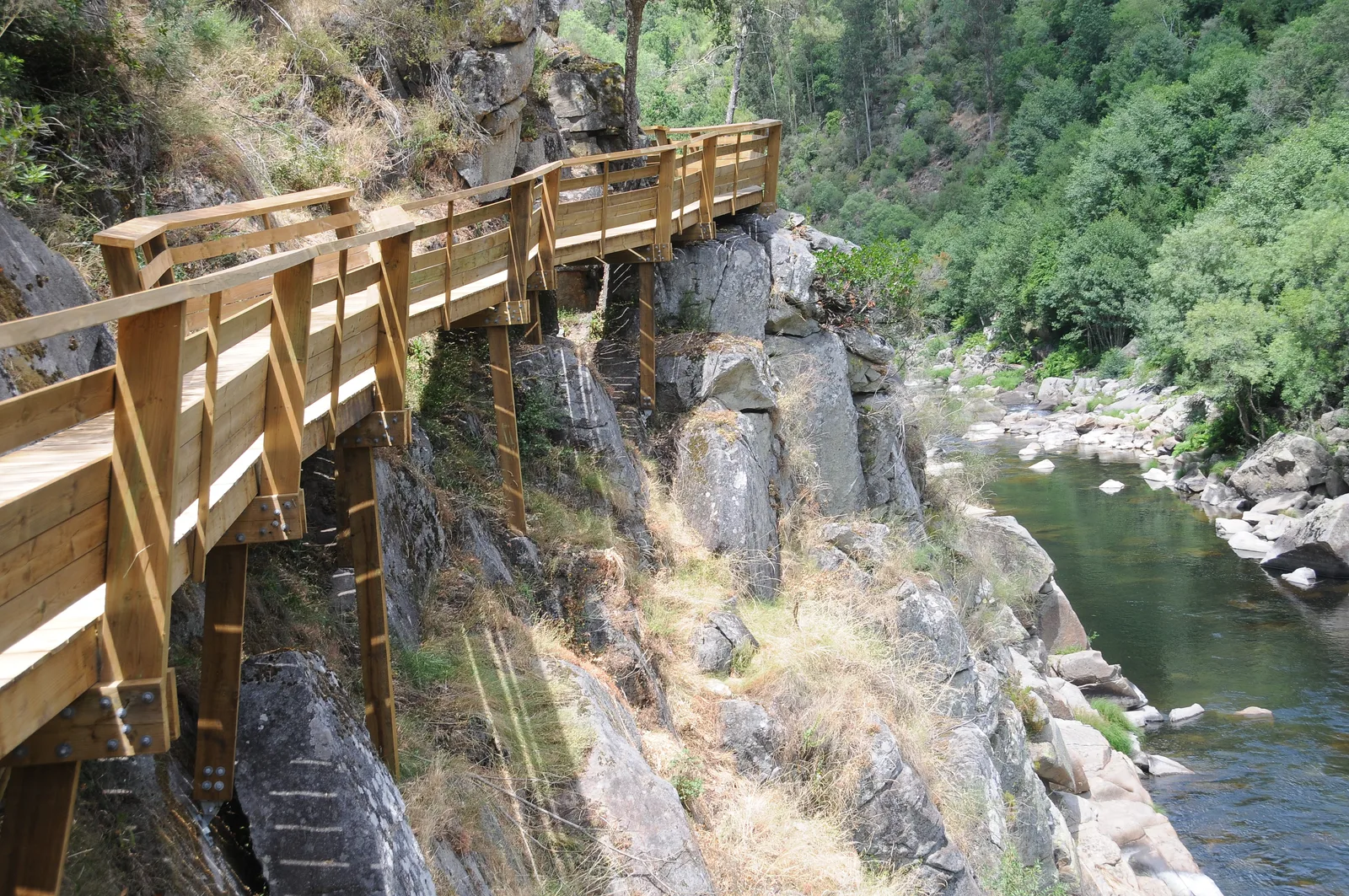
South-east of Porto, where the mountains fold into deep river valleys, Arouca is a town that turned its geology into its future: the whole municipality is the Arouca Geopark, a member of the UNESCO global network, a landscape of schist ridges, waterfalls and the fast Paiva river. The town itself is quiet, its streets gathered around an old monastery tradition; the country around it is the reason to come, and the people here have made a science of showing it. The wooden walkways along the Paiva river start nearby, see Passadiços do Paiva.
A territory made of stone
Arouca’s geopark gathers hundreds of millions of years of rock into walkable country: the shaley ridges, the waterfalls of the Paiva gorge, and the celebrated walkways that run along the river between cliffs and woods. The town keeps the calm of an old monastery town under the mountains of Montemuro, and its festivals and markets fill the calendar. The city of Vila Real is far to the east across the hills, and the terraces of the Douro Valley begin beyond the ridges; Porto is an hour’s drive west.
What to see
- The walkways of the Paiva river
- The rocks and waterfalls of the Arouca Geopark
- The old monastery town of Arouca
- The mountain roads of Montemuro
- The schist villages of the valley
Practical information
Arouca stands in the Aveiro district, in the mountainous east of the Porto metropolitan area, about an hour from Porto by road. The walkways and trails are exposed to sun and river spray: wear shoes with grip, bring water in summer, and check the timed-entry rules of the walkways before travelling.
Image credit: Passadiço do Paiva by Joseolgon — CC BY-SA 4.0, via Wikimedia Commons.
For the high plateau and its schist villages, see Serra da Freita.
Experiences
Explore related experiences


 English (UK)
 Português
 Polski
 Nederlands
 Italiano
 Français
 Español
 Deutsch
 한국어
 简体中文
 Svenska